
The North Sea is one of Europe’s most fascinating and important marine regions. Stretching between the UK, Scandinavia, Germany, and the Netherlands, it has played a vital role in trade, fishing, and energy production for centuries. But beyond its history and economy, many people wonder about the North Sea’s dimensions—how big is it, how deep does it go, and where are its shallowest and deepest points?
In this guide, we’ll break down everything you need to know about the dimensions of the North Sea, from its length, width, and depth to its geographical boundaries and why these features matter today.
North Sea Dimensions: Everything You Need to Know
1. The Big Picture: North Sea Dimensions
1.1 Size and Area
- Length: 970 km (600 miles)
- Width: 580 km (360 miles)
- Surface Area: About 570,000 km² (220,000 sq mi)
- Volume: Around 54,000 km³ of water
That makes the North Sea larger than the state of California and about twice the size of the United Kingdom in surface area.
1.2 Depth and Volume
- Average depth: 90–95 m (300 ft)
- Shallowest areas: 15–30 m (Dogger Bank, southern basin)
- Deepest point: Norwegian Trench, reaching 725 m (2,379 ft)
This wide variation in depth makes the sea both an ecological hotspot and a navigational challenge.
1.3 Extreme Zones
- Dogger Bank: Famous fishing ground, just 15–30 m deep.
- Norwegian Trench: A dramatic submarine valley, plunging to over 700 m.
- Devil’s Hole (near Scotland): Narrow, steep-sided depressions that reach 450 m deep.
These underwater features influence currents, marine life distribution, and even offshore energy development.
2. Boundaries and Coastlines
The North Sea is bordered by:
- West & South: Great Britain (Scotland and England).
- East: Norway, Denmark, and Germany.
- South: The Netherlands, Belgium, and France.
Coastal Landscapes
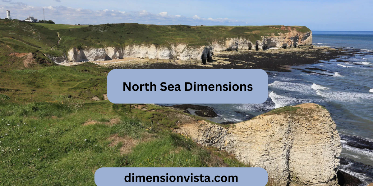
- North & Northwest: Rugged coasts with fjords (Norway) and cliffs (Scotland).
- South & East: Low-lying sandy and marshy coasts, such as the Dutch Wadden Sea.
This contrast explains why the north is known for deep fjords and fishing harbors, while the south is famous for its shipping lanes and ports.
3. Why the Dimensions Matter
3.1 For Navigation
The North Sea is one of the busiest shipping areas in the world. Shallow sandbanks and shifting currents make navigation tricky, so accurate depth mapping is crucial.
3.2 For the Economy
- Home to Rotterdam, Europe’s largest port.
- Major hub for offshore oil and gas since the 1970s.
- Now leading in offshore wind farms, with hundreds of turbines.
3.3 For the Environment
- Shallow southern waters support large fisheries.
- Deep trenches influence water circulation and biodiversity.
- Coastal wetlands, estuaries, and fjords are critical for birds and marine life.
4. Frequently Asked Questions
Q1: How deep is the North Sea?
On average about 90–95 m, but it reaches 725 m in the Norwegian Trench.
Q2: How big is the North Sea compared to other seas?
At 570,000 km², it’s smaller than the Mediterranean but larger than the Black Sea.
Q3: Where are the shallowest areas?
The southern basin, especially Dogger Bank, where depths are under 30 m.
Q4: What is the longest distance across the North Sea?
From north to south, it stretches nearly 970 km.
5. Key Takeaways and Insights
- The North Sea covers 570,000 km², making it one of Europe’s largest seas.
- Depth varies widely, from shallow sandbanks at 15 m to deep trenches over 700 m.
- Its dimensions shape its role in trade, fishing, renewable energy, and ecology.
-
Understanding its size and depth is essential for navigation, marine conservation, and future development.
Conclusion
The North Sea Dimensions: Everything You Need to Know reveal a sea of contrasts—shallow southern fishing grounds, deep northern trenches, busy shipping routes, and fragile ecosystems. Its size (970 km long and 580 km wide) and depth variations (from 15 m shallows to 725 m trenches) make it one of the most strategically and environmentally important seas in the world.
Whether you’re a student, researcher, or just curious, knowing the dimensions of the North Sea helps you understand why this body of water continues to shape Europe’s past, present, and future.